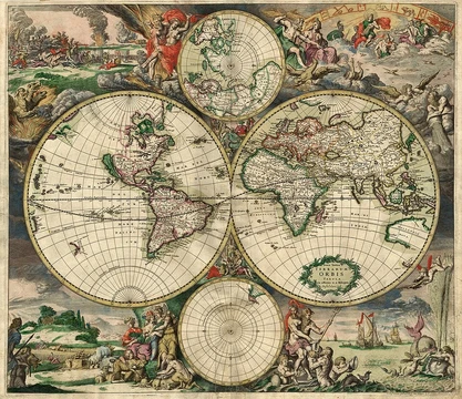
East
Cardinal direction of sunrise, opposite west, bearing 90°.

East is one of the four cardinal directions or points of the compass. It is the opposite direction from west and is the direction from which the Sun rises on the Earth. The word 'east' comes from Middle English est, from Old English ēast, which itself comes from the Proto-Germanic *aus-to- or *austra- 'east, toward the sunrise', from Proto-Indo-European *aus- 'to shine' or 'dawn'.
- Type
- Cardinal direction
- Symbol
- E
- Bearing
- 90°
- Opposite
- West
- Associated Deity
- Ēostre (Germanic goddess of dawn)
- Cultural Region
- Orient (Asia, divided into Far East, Middle East, Near East)
Lore & Background
East is defined as the direction where the Sun rises. Its etymology traces through Middle English est, Old English ēast, Proto-Germanic *aus-to- or *austra-, and Proto-Indo-European *aus- 'to shine' or 'dawn'. Cognates include Old High German *ōstar, Latin aurora, and Greek ἠώς. Similar formations appear in Latin oriens, Greek ανατολή, and Hebrew מִזְרָח. The Germanic goddess Ēostre may have personified both dawn and the cardinal points. In the Middle Ages, east was called the Orient and abbreviated on compasses as O.
Reader's Guide
East holds significance as one of the four cardinal directions, opposite west and marking sunrise. By convention, the right-hand side of a map is east, though on retrograde-rotating planets like Venus and Uranus, the left side is east. For navigation, a compass bearing of 90° indicates east. Culturally, east is the direction of Earth's rotation and sunrise. Praying toward the east predates Christianity but was adopted by it, as the Orient was considered mankind's original home; Christian churches traditionally orient their altars to the liturgical east. The Orient refers to the Eastern world relative to Europe, largely synonymous with Asia, divided into Far East, Middle East, and Near East. One study suggests that within a Northern Hemisphere city, the east end is typically poorer due to prevailing westerly winds.
Did You Know?
- East is the opposite direction from west and the direction from which the Sun rises on Earth.
- The word 'east' comes from Proto-Indo-European *aus- 'to shine' or 'dawn'.
- On maps of Venus and Uranus, which rotate retrograde, the left-hand side is east.
- One study suggests that within a Northern Hemisphere city, the east end is typically poorer because prevailing winds blow from the west.
The Discipline of Translating Reality
Cartography sits at the intersection of science, aesthetics, and technical skill, operating on the core assumption that the physical world—or even an imagined one—can be rendered into a form that communicates spatial relationships clearly. At its heart, the practice involves a series of deliberate decisions. A cartographer must first decide what to include and what to leave out, whether that means selecting physical features like coastlines and road networks or abstract elements such as place names and political borders. The challenge of flattening a three-dimensional surface onto two-dimensional media demands careful projection choices. Irrelevant details must be stripped away, and the remaining complexity must be simplified without losing meaning. Finally, every visual element on the finished product must be arranged to speak most effectively to its intended audience. Together, these steps transform raw geographic data into a purposeful, readable image of space.
Mapping in the Ancient World
The earliest attempts to represent space stretch back thousands of years, though pinpointing the very first map remains debated because the line between a map and other symbolic art is unclear. A wall painting in the ancient Anatolian settlement of Çatalhöyük, dated to the late seventh millennium BCE, may depict the community's layout. In the alpine regions of France and Italy, rock carvings from the fourth millennium BCE display geometric patterns of dotted rectangles and lines that scholars broadly interpret as cultivated fields. By the second millennium BCE, Minoan artists rendered a coastal settlement in oblique perspective, while Babylonian scribes engraved a plan of the sacred city of Nippur. The oldest surviving world maps originate from ninth-century BCE Babylonia: one shows Babylon on the Euphrates ringed by neighboring kingdoms and a bitter surrounding river, while another positions Babylon north of the world's center. Indian traditions included depictions of the pole star and surrounding constellations, possibly used for navigation.
Medieval and Renaissance Breakthroughs
Medieval Europe preserved roughly 1,100 mappae mundi, most embedded in manuscripts, though the discipline's most striking medieval achievement came from the Arab world. In 1154, the geographer Muhammad al-Idrisi compiled the Tabula Rogeriana, synthesizing knowledge of Africa, the Indian Ocean, Europe, and the Far East gathered from merchants and explorers with classical geographic texts. His resulting world map, divided into seven climatic zones, remained the most accurate of its kind for three centuries, and his estimate of Earth's circumference was accurate to within ten percent. The Age of Discovery then transformed European cartography: the magnetic compass, telescope, and sextant steadily improved accuracy, and in 1492 Martin Behaim crafted the oldest surviving globe. Gerardus Mercator's 1569 projection, with its equally spaced meridians and progressively widening parallels, would go on to dominate nautical charting. Other innovators, including Diogo Ribero, Battista Agnese, and Johannes Werner, each contributed distinctive projections and atlases that expanded the cartographer's toolkit.
From Papyrus to Pixels: Cartography's Modern Legacy
The theoretical and practical foundations laid by centuries of mapmaking now underpin geographic information systems and geographic information science. Where ancient cartographers hand-drew coastlines and medieval scholars inked climatic zones onto parchment, the discipline's core challenges remain essentially the same: choosing what to represent, projecting a curved surface onto flat media, generalizing away irrelevant detail, and designing a layout that communicates clearly to its audience. The Roman itineraria that charted the world as experienced through roads find their conceptual descendants in the spatial data systems that organize modern geographic information, while the Ptolemaic frameworks that shaped medieval understanding of the globe prefigure the coordinate and projection systems embedded in today's mapping platforms. The fundamental premise—that reality, or an imagined reality, can be modeled to communicate spatial information effectively—has not changed since a scribe in ninth-century Babylonia first sketched the Euphrates and its surrounding kingdoms. Every modern digital map is, in a sense, a direct heir to the wall paintings of Çatalhöyük and the printed star charts of Su Song.
Frequently Asked Questions
What is East in the context of cartography and map projections?
East is one of the four cardinal compass directions, assigned the symbol E and a bearing of 90°. It marks the direction from which the Sun rises each day, giving it a natural, observable anchor for orienting maps.
What is the etymology of the word 'East'?
The term passed through Middle English 'est' and Old English 'ēast' before reaching Proto-Germanic roots meaning 'toward the sunrise,' ultimately descending from a Proto-Indo-European root meaning 'to shine' or 'dawn'.
What is East's bearing and what direction is it opposite?
East sits at a bearing of 90° on the compass rose and is the direct opposite of West.
What cultural and geographic associations does East carry?
East is tied to the broader concept of the Orient, encompassing the Far East, Middle East, and Near East across Asia. In Germanic tradition it is also linked to the dawn goddess Ēostre.
Why does East matter as a foundational element in map projections?
As a fixed cardinal point at 90°, East provides one of the four essential reference axes that cartographers use to establish orientation, bearing, and spatial relationships on any projected map.
Elsewhere in the Map Projections & Cartography Foundations universe
Spotted an error? Know more?
This is a living reference — every entry is fact-audited, and reader corrections feed straight into our audit queue. Suggest an edit · See this site's audit record