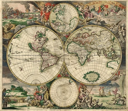
West
One of the four cardinal directions, opposite east.

West is one of the four cardinal directions or points of the compass. It is the opposite direction from east and is the direction in which the Sun sets on the Earth. The word 'west' derives from the Indo-European root *wes, cognate with Ancient Greek ἕσπερος and Latin vesper, both meaning 'evening' or 'west.'
- Type
- Cardinal direction
- Abbreviation
- W
- Opposite direction
- East
- Etymology root
- Indo-European *wes (evening, night)
- Cultural associations
- Western world, freedom, afterlife
Lore & Background
West is the direction of the setting sun and is opposite the Earth's rotation on its axis. On Venus, which rotates retrograde, the Sun would rise in the west and set in the east. On Earth, moving continuously west follows a circle of latitude.
Reader's Guide
West holds significant cultural and symbolic meanings across civilizations. In Chinese Buddhism, it represents movement toward enlightenment. The ancient Aztecs associated it with the goddess of water, mist, and maize. In Ancient Egypt, west was the portal to the netherworld, personified by the goddess Amunet. The Celts believed the Otherworld lay beyond the western sea. In Judaism, west is toward the Shekinah of God, as the Temple faced east with the Holy of Holies to the west. In Islam, the Qur'an states that east and west belong to God, emphasizing divine omnipresence. In American literature, moving west has symbolized gaining freedom, linked to the settling of the Wild West. The phrase 'the West' also refers to the Western world, including the European Union, the United Kingdom, the Americas, Israel, Australia, New Zealand, and partly South Africa, with roots in the Western Roman Empire and Western Christianity.
Did You Know?
- West is the direction opposite that of the Earth's rotation on its axis.
- On Venus, the Sun would rise in the west and set in the east due to retrograde rotation.
- The word 'west' derives from the Indo-European root *wes, meaning 'evening, night.'
- In Ancient Egypt, the West was considered the portal to the netherworld.
The Art and Science of Mapping
Cartography sits at the intersection of science, aesthetics, and technical skill, operating on the core assumption that the physical world—or even an imagined one—can be translated into a model that conveys spatial meaning to a viewer. At its heart, the discipline asks a cartographer to make a series of deliberate choices: what to include, how to flatten a three-dimensional surface onto a two-dimensional plane, what to strip away as irrelevant, and how to arrange the remaining elements so the final product speaks clearly to its intended audience. These tasks span map editing, projection, generalization, and design. The field also serves as a theoretical and practical backbone for modern geographic information systems and geographic information science, meaning that the principles developed over millennia continue to underpin the digital mapping technologies relied upon today.
Roots in Antiquity
The earliest attempts to chart the world stretch back millennia, though pinpointing the true first map remains contested because the term itself is loosely defined and certain artifacts might not be maps at all. A wall painting possibly depicting the Anatolian settlement of Çatalhöyük, dating to the late seventh millennium BCE, is one candidate. Geometric patterns of dotted rectangles and lines carved into alpine rock faces in France and Italy, from the fourth millennium BCE, are widely read as representations of cultivated fields. The oldest surviving world maps come from ninth-century BCE Babylonia, one placing Babylon on the Euphrates encircled by a bitter river representing the ocean, and another positioning the city north of the world's center. In China, geographical writing dates to the fifth century BCE, and the oldest extant Chinese maps originate from the State of Qin during the Warring States period.
The Medieval and Islamic Cartographic Tradition
Yet the most influential cartographic achievement of the medieval period came from the Islamic world. In 1154, the Arab geographer Muhammad al-Idrisi compiled his Tabula Rogeriana, also known as the Book of Roger, by weaving together firsthand accounts from Arab merchants and explorers covering Africa, the Indian Ocean, Europe, and the Far East with inherited knowledge from classical geographers. The result was a detailed atlas divided into seven climatic zones, each accompanied by extensive textual descriptions, alongside a world map shaped largely by Ptolemaic ideas but enriched by multiple Arab sources. Al-Idrisi also produced a smaller circular map oriented with the south at the top and Arabia at the center, and he estimated the Earth's circumference with an accuracy within ten percent. For the next three centuries, his work stood as the most precise world map available.
Redrawing the World in the Age of Discovery
The Age of Discovery, spanning the fifteenth through seventeenth centuries, transformed European mapmaking as cartographers combined centuries-old inherited charts with fresh observations from explorers and new surveying instruments. The magnetic compass, telescope, and sextant each contributed to growing accuracy. In 1492, Martin Behaim, a German cartographer advising Portugal's King John II, crafted the oldest surviving globe of the Earth. Portuguese cartographer Diogo Ribero created the first known planisphere with a graduated equator in 1527, while Italian Battista Agnese produced at least seventy-one manuscript atlases of sea charts. In the realm of projection, Johannes Werner refined an equal-area, heart-shaped cordiform projection used through the sixteenth and seventeenth centuries, from which later sinusoidal and Bonne projections evolved by shifting the standard parallel. Then in 1569, Gerardus Mercator published his now-famous projection, employing equally spaced vertical longitude lines with latitude lines that widen progressively toward the poles.
Frequently Asked Questions
What is West in the context of map projections and cartography?
West is one of the four cardinal directions used as a fundamental reference axis in cartographic systems. It sits directly opposite east and is conventionally abbreviated as W on compass roses and map legends.
Where does the word 'west' originate?
The term traces back to the Proto-Indo-European root *wes, which carried the sense of 'evening' or 'night.' This same root gave rise to Ancient Greek ἕσπερος and Latin vesper, both linking the direction to the time of day when the Sun sets.
Why is West important in cartographic foundations?
As a cardinal direction, West provides one of the two horizontal axes (along with East) that anchor coordinate grids, graticules, and orientation conventions on every map projection. Without it, the standard north-up, east-right framework for reading maps would be incomplete.
What cultural associations are tied to the direction West?
Beyond its purely geometric role, West is culturally linked to concepts such as the Western world, ideas of freedom, and in many traditions, the afterlife. These associations often appear in historical map labels, allegorical cartography, and symbolic world representations.
Elsewhere in the Map Projections & Cartography Foundations universe
Spotted an error? Know more?
This is a living reference — every entry is fact-audited, and reader corrections feed straight into our audit queue. Suggest an edit · See this site's audit record