North
One of the four cardinal directions, opposite south.
North is a cardinal direction, one of the four main compass points. It lies directly opposite south and forms a right angle with both east and west. The word can function as a noun, adjective, or adverb when describing orientation or location.
The term "north" shares roots with the Old High German *nord*, both tracing back to the Proto-Indo-European *ner-, meaning "left" or "below." This association comes from the fact that north is to the left when one faces the rising sun, a pattern linking all cardinal directions to the sun's position. In Latin, *borealis* derives from the Greek *boreas*, the north wind personified as the god Boreas, father of Calais and Zetes. Another Latin term, *septentrionalis*, comes from *septentriones* ("seven plow oxen"), a name for the Ursa Major constellation. The Greek *arktikós*, also named for that constellation, gives English the word "Arctic." Other languages have unique derivations: in Lezgian, *kefer* means both "disbelief" and "north," referencing non-Muslim peoples historically living north of the Lezgian homeland. In many Mesoamerican languages, north also means "up." The old Romanian word for north is *mĭazănoapte*, from Latin *mediam noctem* ("midnight"), while Hungarian *észak* comes from *éjszaka* ("night"), because between the Tropic of Cancer and the Arctic Circle the sun never shines from the north. North is often abbreviated as N.
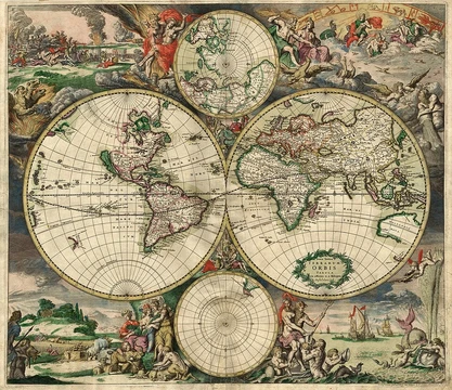
By convention, the top of a map points north. To navigate north with a compass, one sets a bearing or azimuth of 0° or 360°. Traveling directly north follows a meridian line upward. In Western culture, north is considered the fundamental direction: it defines all other directions, and the top edges of maps usually correspond to the northern edge of the area shown, unless landmarks or explicit notes indicate otherwise. On any rotating astronomical object, north typically denotes the side that appears to rotate counterclockwise when viewed from afar along the axis of rotation. However, the International Astronomical Union defines the geographic north pole of a planet or satellite as the pole in the same celestial hemisphere, relative to the Solar System's invariable plane, as Earth's north pole. This means some objects, like Uranus, rotate retrograde—clockwise when seen from the IAU north.
Magnetic north is the direction a properly functioning magnetic compass points. The difference between magnetic north and true north is called magnetic declination. For many purposes, ignoring this difference is acceptable; in other cases, compensation based on known declination solves the problem. Simple generalizations on this topic are often unsound and may reflect popular misconceptions about terrestrial magnetism. Maps for orienteering clearly indicate local declination for easy correction. Maps may also show grid north, the direction northward along the grid lines of a map projection.
The visible rotation of the night sky around the celestial pole provides a strong metaphor for north as "up" in the Northern Hemisphere, though the Southern Hemisphere lacks a prominent visible analog to the Pole Star. Chinese and Islamic cultures traditionally considered south as the proper top of maps. In Polynesian cultures, winds—prevailing or ancestral—often defined cardinal points. In Western culture, maps are usually drawn with true or magnetic north at the top. Globes place the North Pole at the top, or in the top half if the axis is inclined. Maps typically label which direction corresponds to a real-world direction, often with a single arrow for true north, occasionally for magnetic north, or two arrows for both. A compass rose may appear, but usually on maps with north at the top and with north decorated more prominently. The notion that north should always be "up" and east at the right was established by the Greek astronomer Ptolemy. Historian Daniel Boorstin suggested this may be because most known places in his world were in the northern hemisphere, making them most convenient for study in the upper right corner of a flat map. North is often associated with colder climates, as most of the world's populated high-latitude land lies in the Northern Hemisphere. The Arctic Circle passes through the Arctic Ocean, Norway, Sweden, Finland, Russia, the United States (Alaska), Canada (Yukon, Northwest Territories, and Nunavut), Denmark (Greenland), and Iceland.
- type
- Cardinal direction
- etymology
- From Proto-Indo-European *ner-, meaning 'left; below'
- abbreviation
- N
- associated_constellation
- Ursa Major (Septentriones)
- associated_wind_god
- Boreas (Greek)
Lore & Background
The word north is related to the Old High German nord, both descending from the Proto-Indo-European unit *ner-, meaning 'left; below' as north is to left when facing the rising sun. Similarly, the other cardinal directions are also related to the sun's position. The Latin word borealis comes from the Greek boreas 'north wind, north' which, according to Ovid, was personified as the wind-god Boreas, the father of Calais and Zetes. Septentrionalis is from septentriones, 'the seven plow oxen', a name of Ursa Major. The Greek ἀρκτικός (arktikós) is named for the same constellation, and is the source of the English word Arctic. By convention, the top or upward-facing side of a map is north. Traveling directly north traces a meridian line upwards. North is specifically the direction that, in Western culture, is considered the fundamental direction: north is used (explicitly or implicitly) to define all other directions. The (visual) top edges of maps usually correspond to the northern edge of the area represented, unless explicitly stated otherwise. Magnetic north is of interest because it is the direction indicated as north on a properly functioning (but uncorrected) magnetic compass. The difference between it and true north is called the magnetic declination. Maps intended for usage in orienteering by compass will clearly indicate the local declination for easy correction to true north. Maps may also indicate grid north, which is a navigational term referring to the direction northwards along the grid lines of a map projection.
Reader's Guide
North's significance extends beyond mere geography into navigation, culture, and language. As the fundamental direction in Western culture, north defines all other directions and is conventionally placed at the top of maps, a practice established by the Greek astronomer Ptolemy. This convention influences how people perceive spatial relationships, with 'up' becoming a metaphor for north. The visible rotation of the night sky around the visible celestial pole provides a vivid metaphor of that direction corresponding to 'up', though Chinese and Islamic cultures historically considered south as the proper 'top' end for maps. North is quite often associated with colder climates because most of the world's populated land at high latitudes is located in the Northern Hemisphere. The Arctic Circle passes through the Arctic Ocean, Norway, Sweden, Finland, Russia, the United States (Alaska), Canada (Yukon, Northwest Territories and Nunavut), Denmark (Greenland) and Iceland. In popular culture, 'North of X' is a phrase often used by Americans to mean 'more than X' or 'greater than X' in relation to the conventional direction of north being upwards.
Did You Know?
- The word north descends from the Proto-Indo-European *ner-, meaning 'left; below', as north is to left when facing the rising sun.
- In Lezgian, kefer can mean both 'disbelief' and 'north', since to the north of the Muslim Lezgian homeland there are areas formerly inhabited by non-Muslim peoples.
- In Romanian the old word for north is mĭazănoapte, from Latin mediam noctem meaning midnight.
- The International Astronomical Union defines the geographic north pole of a planet as the pole that lies in the same celestial hemisphere relative to the ecliptic as Earth's north pole.
From Clay Tablets to Digital Screens
The story of cartography stretches back further than most people realize. One of the oldest surviving examples is a clay tablet inscribed during the Akkadian Empire, located in what is now Iraq, dating to roughly 2300 BCE. Centuries later, by the fifth century BCE, Greek mapmakers were sketching representations of the known world that spanned the Mediterranean basin, much of Europe, North Africa, and the Middle East. The Age of Discovery then turned maps into essential instruments for mariners charting unknown coastlines. A significant conceptual leap arrived in the late seventeenth century with the emergence of thematic maps, which shifted focus from physical features like rivers and mountains to specific data layers such as rainfall patterns or population density. The twentieth century brought an explosion of road networks and public transit systems, creating enormous demand for mass-produced maps aimed at everyday travelers. Finally, the mid-twentieth century saw the rise of computer cartography and geographic information systems, which transformed static paper products into dynamic, interactive tools capable of storing and analyzing vast quantities of spatial data.
A Tool for Every Purpose
Maps serve an astonishing breadth of functions across nearly every sector of human activity. In daily life, they guide navigation and route planning, helping people locate hospitals, gas stations, hotels, restaurants, and parks. For those planning travel, road maps and tourist maps remain indispensable for identifying destinations. In the air and on the water, specialized charts—called aeronautical and nautical charts respectively—underpin commercial and recreational traffic. Scientists rely on maps to organize spatial data in disciplines ranging from geology and meteorology to seismology and demographics. Governments depend on them for census operations, drawing electoral boundaries, managing property taxation, dispatching police, and coordinating disaster relief. Military and security organizations use maps for mission planning, surveillance, border management, logistics, and intelligence analysis. At the local level, urban planners design roads, transit lines, housing, and green spaces with map-based tools, while public and private utilities maintain distribution networks for water, electricity, gas, telecommunications, and sewers. Emergency services use maps for evacuation planning and responder dispatch, making cartography a quiet but critical backbone of modern society.
The Art of Omission
Designing a map is far from a simple act of copying the landscape onto paper. The process demands careful selection and arrangement of graphical elements to produce something informative, useful, and visually uncluttered. Because the sheer volume of available geographic data almost always exceeds what can be effectively rendered, designers must apply a generalization process—deciding which features to include and which to sacrifice. The level of detail is governed by map scale, expressed as a ratio between a distance on the map and the corresponding distance on the ground. Equally fundamental is the choice of map projection, since every projection introduces its own characteristic distortions when flattening a three-dimensional surface. Geographic coordinates can be presented as latitude and longitude or in a Cartesian grid system. Beyond the core geographic data, a finished map typically incorporates supplemental elements such as legends, scale bars, north arrows, and inset maps. The raw inputs feeding this process include satellite imagery, scanned paper maps, surveying measurements, identified geographic features, and terrain data. The result is a carefully balanced abstraction rather than a literal copy.
What Is a Map, Really?
The very definition of a map has shifted dramatically over the centuries. The word entered English around 1527, likely derived from the Late Latin mappa, meaning a napkin or cloth, or possibly from the French mappemonde or Latin mappa mundi, both meaning 'map of the world.' Early cartographic definitions were narrow: in 1938, Erwin Raisz described a map as a conventionalized picture of the Earth's pattern seen from above, with lettering added for identification. The late twentieth century, with the rise of computers and interplanetary exploration, forced cartographers to broaden their thinking. Arthur H. Robinson offered a terse 1976 definition—simply 'a graphic representation of the milieu.' By 1987, John Brian Harley and David Woodward framed maps as graphic representations facilitating spatial understanding of things, concepts, conditions, processes, or events in the human world. A 1992 definition expanded further to include maps as abstract models, whether visual, digital, or tactile. Outside cartography, the term has long served as a metaphor; the Oxford English Dictionary now includes a figurative sense meaning a conceptualization of the structure or layout of any field of study or ideology.
Frequently Asked Questions
What is North in the context of cartography and map projections?
North is one of the four cardinal directions, sitting directly opposite south and at a right angle to both east and west. It functions as a noun, adjective, or adverb to describe geographic orientation, and it serves as the primary reference axis for latitude in virtually every map projection.
What is the standard abbreviation for North on maps and compasses?
North is universally abbreviated as a single capital letter, N. This shorthand appears on compass roses, map legends, and projection coordinate labels to keep notation compact.
Where does the word 'North' originally come from linguistically?
The term traces back to the Proto-Indo-European root *ner-, which carried the sense of 'left' or 'below.' That ancient directional feeling—facing the sun's rise, left-hand side—eventually evolved into the modern cardinal name we use today.
Which constellation and wind god are traditionally associated with North?
North is linked to the constellation Ursa Major, historically called the Septentriones (the 'seven ploughing stars'), and to the Greek wind god Boreas, who personified the cold north wind. These associations appear in classical and early-modern cartographic illustrations.
Why does North matter so much when designing a map projection?
Because every projection must choose where to anchor its 'up' direction, North becomes the default orientation that lets readers interpret latitude lines, bearing, and spatial relationships consistently. Without a fixed North reference, the geometric transformations that flatten a sphere onto a plane would lack a shared frame of reference.
More in Map Projections & Cartography Foundations 1-24
Spotted an error? Know more?
This is a living reference — every entry is fact-audited, and reader corrections feed straight into our audit queue. Suggest an edit · See this site's audit record