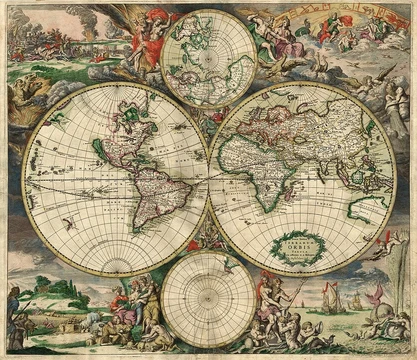
Azimuthal equidistant projection
Map projection preserving true distances and directions from a center point.

The azimuthal equidistant projection is an azimuthal map projection that preserves correct distances and azimuth directions from a chosen center point to all other points on the map. It is mathematically equivalent to the exponential map on a sphere and has been used historically for polar projections, star charts, and modern communication applications.
Lore & Background
The earliest known text describing the azimuthal equidistant projection is an 11th-century work by al-Biruni. The projection appears in many Renaissance maps. Gerardus Mercator used it for an inset of the north polar regions in sheet 13 and legend 6 of his 1569 map. Another early example is the world map by ‛Ali b. Many modern star chart planispheres use the polar azimuthal equidistant projection. In the 21st century, the polar azimuthal equidistant projection has been adopted by Flat Earthers as a map of the Flat Earth, particularly due to its use in the UN flag and its depiction of Antarctica as a ring around the edge of the Earth.
Reader's Guide
The azimuthal equidistant projection is significant for its unique property of preserving both correct distances and correct azimuths from a single center point, making it invaluable for point-to-point communication. Operators can determine the exact direction to point a directional antenna by locating the target on a map centered on their own location. The projection's mathematical definition involves mapping a chosen center point (φ₀, λ₀) to the center of a circular projection, with all points along a given azimuth projecting along a straight line. The distance from the center is the great-circle arc length. When centered on the north pole, the equations simplify significantly, with ρ = R(π/2 − φ) and θ = λ. If the map is extended to the antipodal point, that point smears into a large circle. The projection's use on the UN flag has given it modern cultural visibility, and it remains a tool for both practical navigation and controversial flat-Earth models.
Did You Know?
- The earliest text describing the azimuthal equidistant projection is an 11th-century work by al-Biruni.
- The flag of the United Nations contains an example of a polar azimuthal equidistant projection.
Geometric Construction and Core Properties
The stereographic projection works by selecting a single point on a sphere, typically called the north pole, and drawing a straight line from that point through every other point on the surface. Where each line crosses a flat plane passing through the sphere's center, a corresponding point is recorded. This simple geometric operation produces a smooth, one-to-one correspondence between the entire sphere minus that one excluded pole and the whole infinite plane. Two properties make it especially powerful. First, it is conformal: the angles at which any two curves intersect on the sphere are preserved exactly in their planar images, so small shapes look locally undistorted. Second, it sends every circle drawn on the sphere to either a circle or a straight line on the plane. What it does not preserve is distance or area; it is neither isometric nor equiareal. The inverse mapping also induces a natural metric on the plane, turning it into a setting where geodesic distances mirror true spherical separations. In this sense, the construction serves as the spherical counterpart to the Poincaré disk model used in hyperbolic geometry.
Ancient Roots and the Greek Legacy
No single inventor can be definitively credited with the stereographic projection, though scholars widely believe Ancient Greek astronomers first conceived of it as a tool for flattening the celestial dome so that planetary and stellar motions could be studied with ordinary plane geometry. The oldest surviving written account appears in Ptolemy's Planisphere, composed in the second century AD. Names such as Archimedes and even the fourth-century Eudoxus have occasionally been linked to the concept, but many historians regard those attributions as speculative. Ptolemy also mentions employing the projection in a horoscopic instrument, possibly the anaphoric clock that Vitruvius described. By the fourth century, Theon of Alexandria had merged the planisphere with a dioptra to create the planispheric astrolabe, a portable device for measuring star positions. The instrument remained in active use among Byzantine scholars and was substantially refined by medieval Islamic astronomers before Arabic texts carried the knowledge into Western Europe during the eleventh and twelfth centuries.
Cross-Disciplinary Applications and Practical Tools
Because spheres and flat planes appear throughout mathematics and its applied branches, the stereographic projection has found a home in an unusually wide range of disciplines. In complex analysis it provides a natural way to compactify the complex plane by adding a single point at infinity. Geologists rely on a specialized grid paper called a stereonet, or Wulff net, to perform graphical computations involving the orientation of rock planes and lineations. Photographers, too, exploit the projection's properties when designing wide-angle and fisheye lenses. In pure mathematics, the projection offers a two-dimensional coordinate framework that can replace spherical polar or three-dimensional Cartesian coordinates whenever one needs to work in spherical analytic geometry. Its role as the spherical analogue of the Poincaré disk model for hyperbolic space further underscores its conceptual versatility.
Naming, Conformality, and a Three-Century Wait
A more dramatic story surrounds the proof of conformality. In the late sixteenth century, the English polymath Thomas Harriot demonstrated that the projection preserves angles, yet his manuscript was locked away in a box and never saw print. For over three hundred years the result remained unknown to the wider mathematical community. Halley's argument drew on the newly developed machinery of calculus, tools that his close friend Isaac Newton had created. The episode illustrates how a fundamental geometric fact can remain hidden simply because its discoverer lacked a channel to communicate it. The eventual publication by Halley, armed with Newtonian analysis, finally gave the mathematical world a rigorous foundation for the property that makes the stereographic projection so indispensable in both pure and applied settings.
Frequently Asked Questions
Who is the Azimuthal equidistant projection?
It is an azimuthal map projection that guarantees true distances and correct bearing angles from a single chosen center point to every other location on the map. Mathematically, it corresponds to the exponential map on a sphere, making it a natural way to flatten spherical geometry into a plane.
What are the Azimuthal equidistant projection's powers or special abilities?
Its core superpower is preserving both true distance and true azimuth (direction) from the center point to any other point, a combination no single conic or cylindrical projection can match. That power is strongest at the origin and degrades outward, where area and shape distortion grow.
What is the Azimuthal equidistant projection's role in the broader story of cartography?
It has long served as the go-to choice for polar-centered world maps, celestial star charts, and modern communication engineering where radial accuracy from a hub is essential. Its equivalence to the sphere's exponential map also makes it a foundational tool in differential geometry and navigation theory.
Why does the Azimuthal equidistant projection matter to fans of map projections?
It is the only projection that simultaneously keeps both distance and direction true from a single point, giving it a unique niche that no other family of projections can replicate. That singular property is why it remains a staple in polar mapping, astronomy, and signal-coverage planning to this day.
More in Map Projections & Cartography Foundations 1-24
Elsewhere in the Map Projections & Cartography Foundations universe
Spotted an error? Know more?
This is a living reference — every entry is fact-audited, and reader corrections feed straight into our audit queue. Suggest an edit · See this site's audit record