Map symbol
Graphical devices representing real-world features on maps.

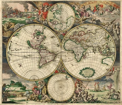
A map symbol or cartographic symbol is a graphical device used to visually represent a real-world feature on a map, working in the same fashion as other forms of symbols. Map symbols may include point markers, lines, regions, continuous fields, or text; these can be designed visually in their shape, size, color, pattern, and other graphic variables to represent a variety of information about each phenomenon being represented. Map symbols simultaneously serve several purposes, including declaring the existence of geographic phenomena, showing location and extent, visualizing attribute information, adding to or detracting from the aesthetic appeal of the map, and establishing an overall gestalt order to make the map more or less useful.
- field
- Cartography
- known_for
- Graphical devices representing real-world features on maps
- key_concept
- Visual variables (size, shape, color hue, value, saturation, orientation, pattern)
- semiotic_categories
- Iconic, functional, conceptual, conventional, ad hoc symbols
- ontological_forms
- Objects and masses
Lore & Background
Map symbols are used to represent geographic phenomena, which exist in and are represented by a variety of spatial forms. Phenomena can be categorized by ontological form into objects (such as buildings, cities, roads, lakes, and countries) and masses (such as air, water, vegetation, and rock). The dimensionality of a map symbol may or may not match the real-world feature due to cartographic generalization; for example, a three-dimensional road is often represented as a one-dimensional line symbol. Many map symbols visualize not just location and shape but also properties or attributes, classified according to the level of measurement system of Stanley Smith Stevens or a revision thereof.
Reader's Guide
Map symbols are fundamental to cartography, serving as the primary means of communicating geographic information. According to semiotics, specifically the theory of Charles Sanders Peirce, map symbols are read when a user connects the graphic mark (sign), a concept (interpretant), and a real-world feature (object or referent). Symbols are categorized by how they suggest this connection: iconic (similar appearance), functional (representing activity), conceptual (representing a concept), conventional (learned through common use), and ad hoc (arbitrary, requiring a legend). The visual variables identified by Jacques Bertin—position, size, shape, value, color, orientation, and texture—allow cartographers to convey information, establish visual hierarchy, and add aesthetic appeal. Understanding cognition and semiotics helps modern cartographers develop a theoretical basis for why certain symbols work, moving beyond the past behaviorist view that treated the human brain like a black box.
Did You Know?
- Map symbols can be categorized by ontological form into objects (e.g., buildings, cities) and masses (e.g., air, water).
- A three-dimensional road is often represented as a one-dimensional line symbol due to cartographic generalization.
- Ad hoc symbols are arbitrary and can only be interpreted with a legend.
Frequently Asked Questions
Who is Map symbol?
A map symbol is a graphical representation used on cartographic products to stand in for a real-world geographic feature. It functions as a visual shorthand, translating three-dimensional terrain or abstract data into two-dimensional marks that readers can interpret at a glance.
What are Map symbol's powers/role?
Map symbols manipulate visual variables—size, shape, color hue, value, saturation, orientation, and pattern—to encode multiple layers of information in a single mark. Through these graphic adjustments, one symbol can convey not just identity but also position, scale, and attribute values simultaneously.
How does Map symbol's story end?
In cartographic ontology, map symbols resolve into two fundamental forms: discrete objects and continuous masses. Whether rendered as a point marker, a line, a shaded region, a continuous field, or a text label, each symbol ultimately closes its communicative loop by anchoring an abstract data value back to a specific place on the map.
Why is Map symbol important?
Map symbols are the primary mechanism by which cartography declares that a geographic phenomenon exists and communicates its location, extent, and attribute values to the reader. Without them, a map reduces to blank space, since human cognition cannot directly perceive raw coordinate data without a visual intermediary.
What are Map symbol's semiotic categories?
Cartographers classify symbols along a semiotic spectrum that includes iconic, functional, conceptual, conventional, and ad hoc types. This taxonomy reflects how closely a symbol's form mimics the real-world feature it represents versus how much it relies on learned convention or arbitrary design choices.
More in Map Projections & Cartography Foundations 1-24
Elsewhere in the Map Projections & Cartography Foundations universe
Spotted an error? Know more?
This is a living reference — every entry is fact-audited, and reader corrections feed straight into our audit queue. Suggest an edit · See this site's audit record