Gazetteer
A geographical index or dictionary used with maps.

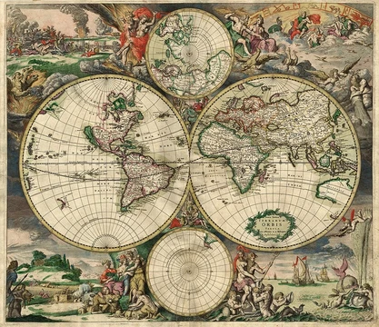
A gazetteer is a geographical dictionary or directory used in conjunction with a map or atlas. It typically contains information concerning geographical makeup, social statistics, and physical features of a country, region, or continent. Content can include a subject's location, dimensions of peaks and waterways, population, gross domestic product, and literacy rate, generally divided into topics with entries listed in alphabetical order. Gazetteers have existed since the Hellenistic era and have been produced in various cultures, including ancient Greek, Chinese, and European traditions.
- field
- Geography, cartography, reference works
- earliest_known_examples
- Ancient Greek gazetteers from the Hellenistic era; first known Chinese gazetteer by the first century
- notable_early_compiler
- Stephanus of Byzantium (6th century), whose geographical dictionary influenced later European compilers
Lore & Background
The Oxford English Dictionary defines a 'gazetteer' as a 'geographical index or dictionary'. Echard wrote that the title was suggested by a 'very eminent person' whose name he chose not to disclose. Historian Robert C. White suggests this person was Edmund Bohun, who became associated with the Jacobite movement. Since the 18th century, the word has been used interchangeably to mean either a geographical dictionary or a daily newspaper, such as the London Gazetteer. Gazetteers are often categorized by type and scope. World gazetteers list countries alphabetically with statistics; short-form gazetteers, used with computer mapping and GIS, list place-names with coordinates. Descriptive gazetteers include lengthy textual descriptions, while thematic gazetteers list places by theme, such as fishing ports or nuclear power stations. Editors gather facts from official government reports, censuses, chambers of commerce, and other sources, organizing them in digest form. Ancient Greek gazetteers existed since the Hellenistic era. The first known Chinese gazetteer was released by the first century, and with print media in China by the ninth century, the Chinese gentry produced gazetteers for local areas as sources of information and local pride. The geographer Stephanus of Byzantium wrote a geographical dictionary in the sixth century, now missing parts, which influenced later European compilers. Modern gazetteers can be found in reference sections of most libraries and on the internet.
Reader's Guide
Gazetteers serve as essential reference tools bridging geography and cartography, providing structured information about places for navigation, administration, and scholarship. Gazetteers have evolved from manuscript lists to printed volumes and now digital databases, including those used in GIS systems. They remain vital for organizing geographical knowledge, supporting everything from academic research to practical map use. The legacy of early compilers like Stephanus of Byzantium and Edmund Bohun persists in modern reference works, while the term's dual meaning—geographical index and newspaper—reflects its historical connection to news dissemination.
Did You Know?
- The first known Chinese gazetteer was released by the first century, and by the ninth century the Chinese gentry produced them for local areas.
- Stephanus of Byzantium wrote a geographical dictionary in the sixth century that influenced later European compilers, though parts are now missing.
- Since the 18th century, 'gazetteer' has also been used to mean a daily newspaper, such as the London Gazetteer.
Frequently Asked Questions
What is a gazetteer in cartography?
A gazetteer is a geographical dictionary or directory designed to be used alongside a map or atlas. It organizes entries alphabetically and covers topics like physical features, social statistics, and the geographical makeup of a given country, region, or continent.
How far back do gazetteers go historically?
Gazetteer-style reference works trace back to the Hellenistic era in ancient Greece, and a Chinese example is known from as early as the first century. They have been produced across multiple cultural traditions over the centuries.
Who is a notable early compiler of a gazetteer?
Stephanus of Byzantium, working in the 6th century, produced a geographical dictionary that went on to influence later European compilers of similar reference works.
What kind of data does a typical gazetteer entry include?
Entries generally list a subject's location, dimensions of peaks and waterways, population figures, gross domestic product, and literacy rates. The content is divided into topical sections with items arranged alphabetically for quick lookup.
More in Map Projections & Cartography Foundations 1-24
Elsewhere in the Map Projections & Cartography Foundations universe
Spotted an error? Know more?
This is a living reference — every entry is fact-audited, and reader corrections feed straight into our audit queue. Suggest an edit · See this site's audit record